Saint-Valentin (Indre)
Saint-Valentin ist eine französische Gemeinde mit 261 Einwohnern (Stand: 1. Januar 2021) im Département Indre in der Region Centre-Val de Loire; sie gehört zum Arrondissement Issoudun und zum Kanton Levroux. Die Einwohner werden Saint-Valentinois genannt.
| Saint-Valentin | ||
|---|---|---|
| ||
| Staat | Frankreich | |
| Region | Centre-Val de Loire | |
| Département (Nr.) | Indre (36) | |
| Arrondissement | Issoudun | |
| Kanton | Levroux | |
| Gemeindeverband | Champagne Boischauts | |
| Koordinaten | 46° 57′ N, 1° 52′ O | |
| Höhe | 140–207 m | |
| Fläche | 24,90 km² | |
| Einwohner | 261 (1. Januar 2021) | |
| Bevölkerungsdichte | 10 Einw./km² | |
| Postleitzahl | 36100 | |
| INSEE-Code | 36209 | |
| Website | http://www.village-saint-valentin.com/ | |
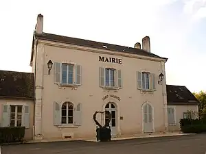 Rathaus von Saint-Valentin | ||

Geographie
Die Gemeinde Saint-Valentin liegt etwa 50 Kilometer westsüdwestlich von Bourges und etwa 27 Kilometer nordnordöstlich von Châteauroux. Umgeben ist Saint-Valentin von den Nachbargemeinden Ménétréols-sous-Vatan im Nordwesten und Norden, Lizeray im Norden und Osten, Saint-Aoustrille im Osten und Südosten, Neuvy-Pailloux im Süden sowie La Champenoise im Südwesten und Westen.
Bevölkerungsentwicklung
| Jahr | 1962 | 1968 | 1975 | 1982 | 1990 | 1999 | 2010 | 2020 |
| Einwohner | 336 | 305 | 281 | 258 | 281 | 276 | 278 | 263 |
| Quellen: Cassini und INSEE | ||||||||
Sehenswürdigkeiten
- Kirche Saint-Valentin
- Park Les Amoreux
 Kirche Saint-Valentin
 Jardin des amoureux
 Schule
 ALLISS-Antenne als Teil des Kurzwellen-Senders der TDF Issoudun
Gemeindepartnerschaft
- St. Valentin in Niederösterreich, seit 1988
Weblinks
Commons: Saint-Valentin – Sammlung von Bildern
This article is issued from Wikipedia. The text is licensed under Creative Commons - Attribution - Sharealike. Additional terms may apply for the media files.