Pirtleville
Pirtleville ist ein Census-designated place im Cochise County im US-Bundesstaat Arizona. Das U.S. Census Bureau hat bei der Volkszählung 2020 eine Einwohnerzahl von 1.412[1] ermittelt.
| Pirtleville | |
|---|---|
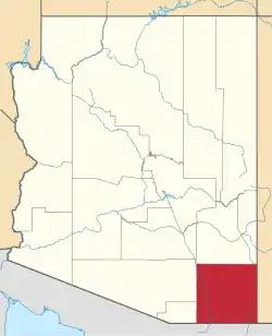
 Lage im County und in Arizona | |
| Basisdaten | |
| Staat: | Vereinigte Staaten |
| Bundesstaat: | Arizona |
| County: | Cochise County |
| Koordinaten: | 31° 22′ N, 109° 34′ W |
| Zeitzone: | Mountain Standard Time (UTC−7) |
| Einwohner: | 1.412 (Stand: 2020) |
| Haushalte: | 388 (Stand: 2020) |
| Fläche: | 4,7 km² (ca. 2 mi²) davon 4,7 km² (ca. 2 mi²) Land |
| Bevölkerungsdichte: | 300 Einwohner je km² |
| Höhe: | 1210 m |
| Postleitzahl: | 85626 |
| Vorwahl: | +1 520 |
| FIPS: | 04-56400 |
| GNIS-ID: | 0009538 |
Pirtleville liegt bei Douglas nahe an der Grenze zu Mexiko. Es wird vom U.S. Highway 191 sowie der Arizona State Route 80 tangiert. Pirtleville hat eine Fläche von 4,7 km², wovon 0 % Wasserfläche ist. Die Bevölkerungsdichte lag bei 300 Einwohnern je km².
Einzelnachweise
- Explore Census Data Pirtleville CDP, Arizona. Abgerufen am 20. Oktober 2022.
| Cities |
Benson • Bisbee • Douglas • Sierra Vista • Tombstone • Willcox |
|
| Towns | ||
| CDPs |
Bowie • Dragoon • Elfrida • McNeal • Mescal • Miracle Valley • Naco • Palominas • Pirtleville • St. David • San Simon • Sierra Vista Southeast • Sunizona • Sunsites • Whetstone |
This article is issued from Wikipedia. The text is licensed under Creative Commons - Attribution - Sharealike. Additional terms may apply for the media files.