Murillo el Fruto
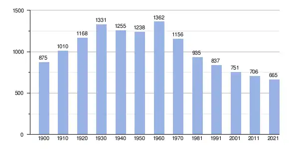
Murillo el Fruto (baskisch Murelu Hautsi) ist ein Ort und eine Gemeinde (Municipio) in der Comunidad Foral Navarra in Nordspanien mit 663 Einwohnern (Stand: 1. Januar 2022).
| Gemeinde Murillo el Fruto | |||
|---|---|---|---|
| Wappen | Karte von Spanien | ||
 |
| ||
| Basisdaten | |||
| Land: | |||
| Autonome Gemeinschaft: | |||
| Provinz: | Navarra | ||
| Comarca: | Erdialdea | ||
| Gerichtsbezirk: | Tafalla | ||
| Koordinaten: | 42° 24′ N, 1° 28′ W | ||
| Höhe: | 361 msnm | ||
| Fläche: | 33,79 km² | ||
| Einwohner: | 663 (1. Jan. 2022)[1] | ||
| Bevölkerungsdichte: | 20 Einw./km² | ||
| Postleitzahl(en): | 31313 | ||
| Gemeindenummer (INE): | 31179 | ||
| Verwaltung | |||
| Bürgermeister: | Diego Palacios Bescos | ||
| Website: | Murillo el Fruto | ||
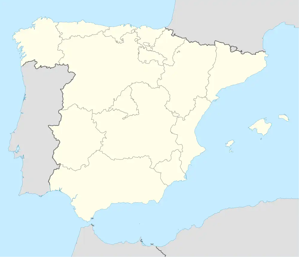
| Lage des Ortes | |||
Karte anzeigen 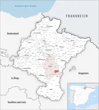 | |||
Lage
Murillo el Fruto liegt etwa 58 km südlich von Pamplona in einer Höhe von ca. 360 m. Die südliche und östliche Gemeindegrenze bildet der Río Aragón.
Bevölkerungsentwicklung der Gemeinde
Sehenswürdigkeiten
- Marienkirche
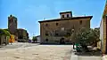 Marienkirche und die sog. Casa Grande
Weblinks
Einzelnachweise
- Cifras oficiales de población de los municipios españoles en aplicación de la Ley de Bases del Régimen Local (Art. 17). Instituto Nacional de Estadística (Bevölkerungsstatistiken des Instituto Nacional de Estadística, Stand 1. Januar 2022).
Abáigar | Abárzuza | Abaurregaina | Abaurrepea | Aberin | Ablitas | Adiós | Aguilar de Codés | Aibar | Allín | Allo | Alsasua | Améscoa Baja | Ancín | Andosilla | Ansoáin | Anue | Añorbe | Aoiz | Araitz | Arakil | Aranarache | Aranguren | Arano | Arantza | Aras | Arbizu | Arce | Los Arcos | Arellano | Areso | Arguedas | Aria | Aribe | Armañanzas | Arróniz | Arruazu | Artajona | Artazu | Atez | Auritz | Ayegui | Azagra | Azuelo | Bakaiku | Barañáin | Barásoain | Barbarin | Bargota | Barillas | Basaburua | Baztan | Beintza-Labaien | Beire | Belascoáin | Bera | Berbinzana | Beriáin | Berrioplano | Berriozar | Bertizarana | Betelu | Bidaurreta | Biurrun-Olcoz | Buñuel | Burgui | Burlada | El Busto | Cabanillas | Cabredo | Cadreita | Caparroso | Cárcar | Carcastillo | Cascante | Cáseda | Castejón | Castillonuevo | Cintruénigo | Cirauqui | Ciriza | Cizur | Corella | Cortes | Desojo | Dicastillo | Donamaria | Doneztebe | Echarri | Egüés | Elgorriaga | Enériz | Eratsun | Ergoiena | Erro | Eslava | Esparza de Salazar | Espronceda | Estella | Esteribar | Etayo | Etxalar | Etxarri Aranatz | Etxauri | Eulate | Ezcabarte | Ezcároz | Ezkurra | Ezprogui | Falces | Fitero | Fontellas | Funes | Fustiñana | Galar | Gallipienzo | Gallués | Garaioa | Garde | Garínoain | Garralda | Genevilla | Goizueta | Goñi | Güesa | Guesálaz | Guirguillano | Hiriberri | Huarte | Ibargoiti | Igantzi | Igúzquiza | Imotz | Irañeta | Irurtzun | Isaba | Ituren | Iturmendi | Iza | Izagaondoa | Izalzu | Jaurrieta | Javier | Juslapeña | Lakuntza | Lana | Lantz | Lapoblación | Larraga | Larraona | Larraun | Lazagurría | Leache | Legarda | Legaria | Leiza | Lekunberri | Leoz | Lerga | Lerín | Lesaka | Lezáun | Liédena | Lizoain | Lodosa | Lónguida | Lumbier | Luquin | Luzaide | Mañeru | Marañón | Marcilla | Mélida | Mendavia | Mendaza | Mendigorría | Metauten | Milagro | Mirafuentes | Miranda de Arga | Monreal | Monteagudo | Morentin | Mues | Murchante | Murieta | Murillo el Cuende | Murillo el Fruto | Muruzábal | Navascués | Nazar | Noáin | Obanos | Ochagavía | Oco | Odieta | Oitz | Oláibar | Olazti | Olejua | Olite | Ollo | Olóriz | Olza | Orbaizeta | Orbara | Orísoain | Orkoien | Oronz | Oroz-Betelu | Orreaga | Oteiza | Pamplona | Peralta | Petilla de Aragón | Piedramillera | Pitillas | Puente la Reina | Pueyo | Ribaforada | Romanzado | Roncal | Sada | Saldias | Salinas de Oro | San Adrián | San Martín de Unx | Sangüesa | Sansol | Santacara | Sarriés | Sartaguda | Sesma | Sorlada | Sunbilla | Tafalla | Tiebas-Muruarte de Reta | Tirapu | Torralba del Río | Torres del Río | Tudela | Tulebras | Úcar | Uharte Arakil | Ujué | Ultzama | Unciti | Unzué | Urdazubi | Urdiain | Urraúl Alto | Urraúl Bajo | Urrotz | Urroz-Villa | Urzainqui | Uterga | Uztárroz | Valtierra | Viana | Vidángoz | Villafranca | Villamayor de Monjardín | Villatuerta | Villava | Yerri | Yesa | Zabalza | Ziordia | Zizur Mayor | Zubieta | Zugarramurdi | Zúñiga