Le Grès
Le Grès ist eine französische Gemeinde mit 465 Einwohnern (Stand 1. Januar 2021) im Département Haute-Garonne in der Region Okzitanien. Sie gehört zum Arrondissement Toulouse und zum Kanton Léguevin. Die Einwohner werden Grésains und Grésaines genannt.
| Le Grès | ||
|---|---|---|
| ||
| Staat | Frankreich | |
| Region | Okzitanien | |
| Département (Nr.) | Haute-Garonne (31) | |
| Arrondissement | Toulouse | |
| Kanton | Léguevin | |
| Gemeindeverband | Hauts Tolosans | |
| Koordinaten | 43° 43′ N, 1° 6′ O | |
| Höhe | 159–284 m | |
| Fläche | 8,13 km² | |
| Einwohner | 465 (1. Januar 2021) | |
| Bevölkerungsdichte | 57 Einw./km² | |
| Postleitzahl | 31480 | |
| INSEE-Code | 31234 | |
| Website | www.legres.fr | |
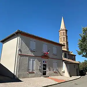 Rathaus (Mairie) und Kirchturm im Hintergrund | ||

Geographie
Le Grès liegt etwa 30 Kilometer westnordwestlich von Toulouse. Umgeben wird Le Grès von den Nachbargemeinden Pelleport im Norden und Nordosten, Thil im Osten, Garac im Süden, Caubiac im Westen sowie Cadours im Nordwesten.
Bevölkerungsentwicklung
| Jahr | 1962 | 1968 | 1975 | 1982 | 1990 | 1999 | 2006 | 2013 | 2020 |
| Einwohner | 157 | 144 | 147 | 200 | 214 | 223 | 267 | 406 | 443 |
| Quelle: Cassini und INSEE | |||||||||
Sehenswürdigkeiten
- Kirche Notre-Dame, erbaut Mitte des 19. Jahrhunderts

Kirche Notre-Dame
Literatur
- Le Patrimoine des Communes de la Haute-Garonne. Flohic Editions, Band 1, Paris 2000, ISBN 2-84234-081-7, S. 424–425.
Weblinks
Commons: Le Grès – Sammlung von Bildern
This article is issued from Wikipedia. The text is licensed under Creative Commons - Attribution - Sharealike. Additional terms may apply for the media files.