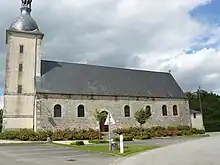
Le Cercueil
Le Cercueil ist eine Gemeinde im französischen Département Orne in der Normandie. Sie gehört zum Arrondissement Alençon und zum Kanton Sées.
| Le Cercueil | ||
|---|---|---|
| ||
| Staat | Frankreich | |
| Region | Normandie | |
| Département (Nr.) | Orne (61) | |
| Arrondissement | Alençon | |
| Kanton | Sées | |
| Gemeindeverband | Communauté de communes des Sources de l’Orne | |
| Koordinaten | 48° 36′ N, 0° 1′ O | |
| Höhe | 232–373 m | |
| Fläche | 13,23 km² | |
| Einwohner | 141 (1. Januar 2021) | |
| Bevölkerungsdichte | 11 Einw./km² | |
| Postleitzahl | 61500 | |
| INSEE-Code | 61076 | |

Lage
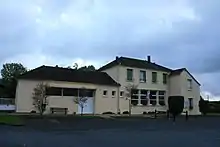
Das Gemeindegebiet wird vom Flüsschen Thouane durchquert, das zur Orne entwässert. Nachbargemeinden sind La Bellière im Nordwesten, Montmerrei im Norden, Mortrée mit Saint-Hilaire-la-Gérard im Osten, Tanville im Süden und La Lande-de-Goult im Westen.
Bevölkerungsentwicklung
| Jahr | 1962 | 1968 | 1975 | 1982 | 1990 | 1999 | 2008 | 2015 | 2020 |
|---|---|---|---|---|---|---|---|---|---|
| Einwohner | 189 | 145 | 179 | 145 | 120 | 143 | 148 | 139 | 138 |
Weblinks
Commons: Le Cercueil – Sammlung von Bildern, Videos und Audiodateien
This article is issued from Wikipedia. The text is licensed under Creative Commons - Attribution - Sharealike. Additional terms may apply for the media files.