Kanton La Plaine d’Illibéris
La Plaine d’Illibéris (katalanisch La Plana d'Illiberis) ist ein französischer Kanton in den Arrondissements Céret und Perpignan, im Département Pyrénées-Orientales und in der Region Okzitanien; sein Hauptort ist Elne.
| Kanton La Plaine d’Illibéris | |
|---|---|
| Region | Okzitanien |
| Département | Pyrénées-Orientales |
| Arrondissement | Céret (8 Gemeinden) Perpignan (1 Gemeinde) |
| Hauptort | Elne |
| Einwohner | 33.162 (1. Jan. 2021) |
| Bevölkerungsdichte | 425 Einw./km² |
| Fläche | 78,07 km² |
| Gemeinden | 9 |
| INSEE-Code | 6612 |
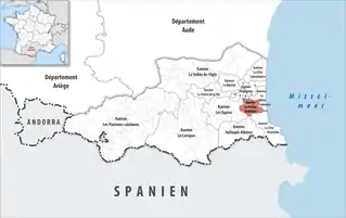 Lage des Kantons La Plaine d’Illibéris im Département Pyrénées-Orientales | |
Gemeinden
Der Kanton besteht aus neun Gemeinden mit insgesamt 33.162 Einwohnern (Stand: 1. Januar 2021) auf einer Gesamtfläche von 78,07 km²:
| Gemeinde | Einwohner 1. Januar 2021 |
Fläche km² |
Dichte Einw./km² |
Code INSEE |
Postleitzahl | Arrondissement |
|---|---|---|---|---|---|---|
| Alénya | 3.619 | 5,34 | 678 | 66002 | 66200 | Céret |
| Bages | 4.482 | 11,95 | 375 | 66011 | 66670 | Céret |
| Corneilla-del-Vercol | 2.561 | 5,43 | 472 | 66059 | 66200 | Céret |
| Elne | 9.428 | 21,29 | 443 | 66065 | 66200 | Céret |
| Latour-Bas-Elne | 3.221 | 3,31 | 973 | 66094 | 66200 | Céret |
| Montescot | 1.612 | 6,02 | 268 | 66114 | 66200 | Céret |
| Ortaffa | 1.798 | 8,49 | 212 | 66129 | 66560 | Céret |
| Théza | 2.171 | 4,83 | 449 | 66208 | 66200 | Céret |
| Villeneuve-de-la-Raho | 4.270 | 11,41 | 374 | 66227 | 66180 | Perpignan |
| Kanton La Plaine d’Illibéris | 33.162 | 78,07 | 425 | 6612 | – | – |
This article is issued from Wikipedia. The text is licensed under Creative Commons - Attribution - Sharealike. Additional terms may apply for the media files.