Kanton Anet
Der Kanton Anet ist ein französischer Wahlkreis im Arrondissement Dreux, im Département Eure-et-Loir und in der Region Centre-Val de Loire; sein Hauptort ist Anet.
| Kanton Anet | |
|---|---|
| Region | Centre-Val de Loire |
| Département | Eure-et-Loir |
| Arrondissement | Dreux |
| Hauptort | Anet |
| Einwohner | 24.986 (1. Jan. 2021) |
| Bevölkerungsdichte | 87 Einw./km² |
| Fläche | 288,85 km² |
| Gemeinden | 25 |
| INSEE-Code | 2801 |
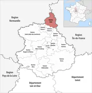 Lage des Kantons Anet im Département Eure-et-Loir | |
Gemeinden
Der Kanton besteht aus 25 Gemeinden mit insgesamt 24.986 Einwohnern (Stand: 1. Januar 2021) auf einer Gesamtfläche von 288,85 km²:
| Gemeinde | Einwohner 1. Januar 2021 |
Fläche km² |
Dichte Einw./km² |
Code INSEE |
Postleitzahl |
|---|---|---|---|---|---|
| Abondant | 2.427 | 34,8 | 70 | 28001 | 28410 |
| Anet | 2.696 | 7,85 | 343 | 28007 | 28260 |
| Berchères-sur-Vesgre | 849 | 11,99 | 71 | 28036 | 28260 |
| Boncourt | 271 | 3,71 | 73 | 28050 | 28260 |
| Boutigny-Prouais | 1.663 | 32,5 | 51 | 28056 | 28410 |
| Broué | 882 | 12,03 | 73 | 28062 | 28410 |
| Bû | 2.022 | 22,6 | 89 | 28064 | 28410 |
| Cherisy | 1.827 | 12,38 | 148 | 28098 | 28500 |
| Germainville | 330 | 8,67 | 38 | 28178 | 28500 |
| Gilles | 490 | 7,26 | 67 | 28180 | 28260 |
| Goussainville | 1.309 | 13,04 | 100 | 28185 | 28410 |
| Guainville | 673 | 14,12 | 48 | 28187 | 28260 |
| Havelu | 127 | 3,7 | 34 | 28193 | 28410 |
| La Chapelle-Forainvilliers | 202 | 5,38 | 38 | 28076 | 28500 |
| La Chaussée-d’Ivry | 1.294 | 8,39 | 154 | 28096 | 28260 |
| Le Mesnil-Simon | 572 | 9,17 | 62 | 28247 | 28260 |
| Marchezais | 406 | 2,19 | 185 | 28235 | 28410 |
| Montreuil | 522 | 6,21 | 84 | 28267 | 28500 |
| Oulins | 1.191 | 10,08 | 118 | 28293 | 28260 |
| Rouvres | 833 | 16,24 | 51 | 28321 | 28260 |
| Saint-Lubin-de-la-Haye | 918 | 14,32 | 64 | 28347 | 28410 |
| Saint-Ouen-Marchefroy | 297 | 9,21 | 32 | 28355 | 28260 |
| Saussay | 1.099 | 4,59 | 239 | 28371 | 28260 |
| Serville | 364 | 5,62 | 65 | 28375 | 28410 |
| Sorel-Moussel | 1.722 | 12,8 | 135 | 28377 | 28260 |
| Kanton Anet | 24.986 | 288,85 | 87 | 2801 | – |
Bis zur landesweiten Neuordnung der französischen Kantone im März 2015 gehörten zum Kanton Anet die 20 Gemeinden Abondant, Anet, Berchères-sur-Vesgre, Boncourt, Broué, Bû, Gilles, Goussainville, Guainville, Havelu, La Chaussée-d’Ivry, Le Mesnil-Simon, Marchezais, Oulins, Rouvres, Saint-Lubin-de-la-Haye, Saint-Ouen-Marchefroy, Saussay, Serville und Sorel-Moussel. Sein Zuschnitt entsprach einer Fläche von 223,71 km2.
This article is issued from Wikipedia. The text is licensed under Creative Commons - Attribution - Sharealike. Additional terms may apply for the media files.